


- 10,313 views, 14 today
- 681 downloads, 0 today

132
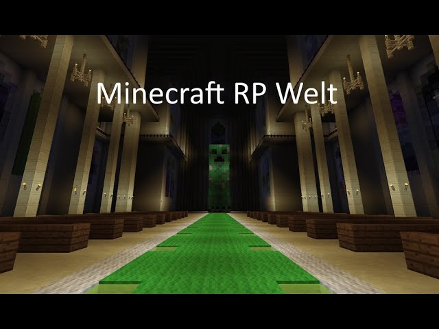
This world was started in November 2011 as a small creative World with the intention to build a desert city. I always imagined it as a roleplay world, with its own characters, stories, religions and factions. The oldest part of this map therefore is the desert city of Kairnous. To be honest I was much younger in this time and my building skills were not as much developed than today, but I kept my world and involved my brother and some friends to build in there. Over the years the project became much bigger and also the quality of our buildings became better. The World has now several regions with different factions, many books dungeons and secrets. There is a currency system based on Gold (nuggets, ingots, blocks) and a complete self-made trading system.
You could host the world on a server and populate it and roleplay your stories, or just explore the world find secrets and ancient tombs and have some bossfights against mighty wardens to get epic loot. Or you use it for war games or battle royal game modes.
Please note that the whole world is in German! Even though this should be no problem if you just want to explore it. Just keep in mind that all signs, books and renamed items are in German.
You can visit up to five regions at the moment and more are planned, with featuring all their own culture, religion, structures, wonders and cities. These are based on real life regions, lore from several fantasy universes and videogames. Some buildings are actually rebuilds. Also not all buildings were created in creative. Some were built in survival and exported to the server map.
As PMC only supports 20 pictures and you maybe don't want to watch the video you could also take a look for most impressiv construction of the world at the 'buildings' box at the end of the description!
Regions:
Die Wüste von Ägypten (eng.: The desert of Egypt)
A hot and sandy land in an endless desert. The eastern part is revolutionizing against the tyranny of their reign. As the oldest region of the map it lies quite in the center of the world. The land is split between two religious groups. One side worships the old Egyptian goods and the other side worships the Roman good "Erbauer" (eng.: Builder).The capitol is the city of Kaironus exactly in the middle of the map.
Egypt does not represent the old Egyptian culture only; it holds also influence of Roman, Arabic and Medieval age.
Architectural style:
While the Western parts keep more to the ancient Egyptian bulding style the Eastern is a mix of Arabic, Roman and Egyptian style. Most used materials are birch wood, oak wood, sandstone and Quartz.
"Das Kaiserreich von Kaysang (eng.: Empire of Kaysang)
This land is inspired by the far east Asian cultures. The regions lay the eastern part of the map. The capital is Kaysang. Most people worship the Big Dragoon.
Architectural style:
Well east Asian - I guess you know what to expect; Pagodas everywhere.
Most used blocks are (dark) oak wood, spruce wood, and cobblestone.
"Nova Republica Romani" (eng.: New Roman Republic | ger.: Neu römische Republic) - short 'NRR'
The roman republic is located in south of the map. It is a modern and huge empire that also has colonies far away like Ariad a place you can only reach traveling with ships and lies in the far ocean. Capital is the City of Roma. Most people worship the "Erbauer" but there are also people that warship the old Roman Pantheon or are Immigrants that kept their own religion.
Architectural style:
The architectural style of the Roman cities and villages shows both Roman antiquity and the European Medieval Ages
Preference is bricks, cobble stones, an oak, but also quartz for most expensive buildings. The city of Roma makes an exception. Here, all building materials are wildly messed up to show the international appeal.
Nordera
This cold land in the far north is ruled by many Jarls and the big Innos church (inspired by the Gothic-saga). The people are rich at metal and are forced to worship Innos or his brother Adanos. Other religions are hunted by the inquisition of the Innos-Church.
Architectural style:
Nordera represents the early and high Medieval of Europe plus the classical norse stlye. The Northern parts (Nordnordera) are focused on the building and live style of viking and other norse. The Southern Parts are more 'german' - also castles, churches, smaller towns and prefer to build with stone. Most building are built with spruce wood, cobblestone or dark oak wood. There are also the ice nomads (the lowest people in nordera) that live in Iglus and other snow build houses.
"Royaum Normanndia" (Königreich Normanndia / Kingdom of Normanndia)
A freudal monarchy between Nordera and Egypt that belonged to Nordera for a longer time but is independet today. Normanndia is very inspired from the real freudal French (like seen in language).
Architectural style:
In Normanndia there are lot of wooden buildings; the few city are not big but tight. The most used blocks are Oak-Wood, Dark-Oak Wood, Birch Wood, Spruce Wood, Cobblestone, Stone Bricks and Blackstone
Rote Wüste (Red Desert)
A hot land in west of the Egyptian desert the represents the real former African Empires and Kingdoms. The land is full of sand and lacks on water but it is settled by many people because of rich minerals hidden by a red sand; especially gold. The Egyptian Empire has also some influence and hold some parts in East directly. In addition to the Egyptians, there are also the Nubians, Eithopen and Malien people.
Barbaricum
An upcomming part of the world that will be found in (south) west of the RP World. We are not 100% sure where the NRR will ends and the Barbaricum will starts. For example Kaer Scrios is set by barbarians but is not part of the geographic Barbaricum. The Barbaricum will contains a lot of Forrests and smaller towns instead of bigger cities. The local gallic and germanic barbarians are more or less friendly to the Romans, who tries to get in controll over the full land.
Wüste Göba (Goeba-Desert)
Gäba is another upcomming part of the RP-World that is loacated at the East. Like the Red Desert Göba is not controlled by one strong power. It represents the real Central Asian plains and deserts. For sure there will be nomadic tribes inspired from Mongolian and Huns that causes the build of the Great Wall in West. In earlier times larger parts of the area was controlled by Kaysang Empire which build some colony cities but Kaysang has lost all controll over these cities who are now independet trading cities who pays the horse lords for their protection. Today Romans and Kaysangians tries to get in controll over Western Parts (again) but the local horse lords offer heavy resistance and the success of the colonialists stands on very insecure feet
Maybe Göba will also hold a Persian Nation but that isn't sure yet.
Mods and texture packs:
This world was created to be used by everyone. Because of this we DO NOT use any mods on the world. All buildings are created in the default texture pack (programmer art - since 1.14).
Progress:
I am forced to state of progress of the project. This doesn’t really fit in this map. I and my friends will keep expanding this map as long as we have fun playing Minecraft. Some regions are more complete than others but that will you see on your own.
Mit dieser Welt habe ich im November 2011 begonnen; seinerzeit noch als kleine Creative-Karte mit der Vorstellung dort eine Wüstenstadt zu errichten. Dabei hatte ich stets eine gewisse Geschichte im Kopf und stellte mit vor, dass es in der Welt verschiedene Charaktere, Fraktionen und Religionen gäbe. Damals war ich noch deutlich jünger und meine Baukünste ließen zu wünschen übrig. Dies besserte sich mit der Zeit, dennoch empfinde ich einige alte Gebäude heute längst nicht mehr so ästhetisch wie damals. Manches wurde zwischenzeitlich überarbeitet, manches bleibt aus Nostalgiegründen da. Die Welt wuchs immer weiter und auch mein Bruder und einige Freunde haben schließlich begonnen an der Welt mitzuarbeiten. Mittlerweile besitzt die Welt fünf Regionen mit einem eigenen Währungssystem basierend auf Gold (Nuggets, Barren, Blöcke) und ein ausgefeiltes System aus NCP-Händlern mit welchem Handel zwischen den Regionen möglich ist.
Die Welt lässt sich als Grundlage für einen Roleplay Server nutzen, eignet sich aber auch dafür einfach herumzustreifen und entdeckt zu werden. Es gibt neben monumentalen Bauwerken auch viele Geheimnisse, Gräber und Verliese, welche teilweise auch mit Wächtern und sogar Bossen bestückt sind. Auch eignet sich die Map als Grundlage für battle royal Spiele.
Die aktuellen 6 Regionen sind noch nicht das Ende. Sowohl die aktuellen Regionen als auch zusätzliche neue Regionen werden hinzugefügt, solange ich und meine Freunde Lust haben Minecraft weiter zu spielen. Die Welt ihre Bewohner und Bauwerke sind oft realen Gegebenheit nachempfunden, aber auch häufig aus Fantasyuniversen und anderen Spielen (wie beispielsweise der Gothic-Reihe) entlehnt. Über die Hintergründe der Welt berichtigen einige Bücher die man überall auf der Welt finden kann.
Die Welt wurde zu 95% in deutscher Sprache verfasst. Im römischen Gebiet gibt es einige religiöse Text oder Wegschilder in Latein, welche jedoch nur der kulturellen Untermalung dienen. Ähnliches gilt die Nutzung der französischen Sprache innerhalb Normanndias und diverser skandinavischen Sprachen (insb. isländisch) für Nordnordera
Buildings
As this here is a minecraft world we created this spoiler Box where we present many of the very cool monumental buildings of the RP-World. Most of them are uploaded as a stand alone project here on Planet Minecraft - so you can easly download them without downloading the full RP-World. Also you don't have to extract them by yourselves when you want to. It would be nice if you would credit our creations when using them - but as we cannot proof it anyways it is uppon you to be honest.
Collection of the RP-World-Stand-Alone-Projects.
Collection of the RP-World-Stand-Alone-Projects.
Building in the New Roman Republic
| Name | Place to Found | Stand Alone? | Picture |
| Circus Maximus | Hipporia, Latinum, NRR | Yes |  |
| Therma Magna Republicae | Rome, Latinum, NRR | Yes |  |
| Capitolium | Roma, Latinum, NRR | No |  |
| Colosseum | Rome, Latinum, NRR | No |  |
| Bacchus Theater | Rome, Latinum, NRR | Yes |  |
| Castrum Caesarea Galliae | Caesarea Gallia, Northern Gallia, NRR | Yes |  |
| Curia Republicae (Fromer Imperial Palace) | Rome, Latinum, NRR | No |  |
| Curia Scipionesis | Scipnia, Scipionesis, NRR | No |  |
| Curia Omnes Coloniarum | Rome, Latinum, NRR | Yes |  |
| Clock Tower of Rome | Rome, Latinum, NRR | Yes |  |
| Templum Junonis Anneae | Octordrum, Alpina, NRR | Yes |  |
| Theater Caesareae | Caesarea Gallia, Northern Gallia, NRR | Yes |  |
| Therma-Imperatoris-Caesaris-Neronis-Augusti (Destroyed) | Acina, Northern Gallia, NRR | Kind of |  |
| Basilica Julia | Rome, Latinum, NRR | Yes |  |
| Templum Juno-Annea | Octodrum, Alpina, NRR | Yes | |
| Ecclesia Sanctus Sebastianus | Rome, Latinum, NRR | Yes |  |
| Therma Catonis ad Caesareá | Caesarea Galliae, Northern Gallia, NRR | Yes |  |
| Trade Workshop fo Caesarea | Caesarea Gallia, Northern Gallia, NRR | Yes |  |
| Trade Workshop of the Roman Colonial Trading Company | Rome, Latinum, NRR | No |  |
| Harbour of Ariad | Ariad, Ariadnus | No |  |
| Villa Scipionum | Sciponia, Scipionesis, NRR | Yes |  |
| Villa Brutorum | Roma, Latinum, NRR | No |  |
| Villa Catonum | Geneva, Republican Gallia, NRR | No |  |
| Villa Ciceronum | Linicum, Asia, NRR | No |  |
| Villa Octaviorum | Octrodrum, Alpina, NRR | No |  |
| Villa Aggripinarum / Curia Silvae Druidis | Tiberia, Silva Druidis, NRR | No |  |
| Villa Cambriarum | Northern Latinum, NRR | Yes |  |
| Villa Liviarum | Maxicum, Lividia, NRR | Yes |  |
| Mausoleum Gaii Julii Caesaris | Rome, Latinum, NRR | Yes |  |
| Gate of Mahara | Mahara, Alpina, NRR | No |  |
| West-Gate of Rome (Porta Julii) | Rome, Latinum, NRR | No |  |
| Castellum Caerulei Bantzinis | Bantzino | Yes |  |
| Castellum Quisbadis | Quisbadis, Asia, NRR | Yes |  |
| Castellum Tutilum | Umidum, Scipionensis | Yes |  |
| Arx Nebulae | Arx Nebulae, Lividia | No |  |
| Arx Aratrium and Aquaeduct Latini | Aratrium, Latinum, NRR | No |  |
| Aquaeduct Lividae | Maxicium, Livida, NRR | No |  |
| Kaer Scrios (Castellum Silvanus) | Deep Forest, Silva Druidis, NRR | Yes |  |
| Universita Quisbadis | Quisbadis, Asia, NRR | Yes |  |
Buildings of the Egyptian Empire
| Name | Location | Standalone? | Picture |
| Horus Temple of Petarum | Petarum, West Desert | Yes |  |
| Osiris Temple of Thebas | Thebas, Southern Desert | Yes |  |
| St. Elistar Cathedral | Kaironus, Eastern Desert | Yes |  |
| House of Seth | Camassda, Central Desert | Yes |  |
| Seth-Pyramid | Camassda, Central Desert | Yes |  |
| Re-Pyramid | Pharos, Northern Desert | No |  |
| Ridwan Star Observatory | Ridwana, Northern Desert | Yes |  |
| Loin Watch | Lionpass, Central Desert | Yes |  |
| Odeon Pharosis | Pharos, Northern Desert | Yes |  |
| Town Centre of Petarum | Petarum, West Desert | Yes |  |
| Library of the Pharosian University | Pharos, Northern Desert | Yes |  |
| Ermani's Fortress | Bashteda, Eastern Desert | Yes |  |
| Eccelsia Shopiae | Pharos, Northern Desert | Yes |  |
| Old Fortress Migdolé | Migdolé, Western Desert | No |  |
| New Fortress Migdolé | Migdolé, Western Desert | No |  |
| Library of Alexia | Kaironus, Eastern Desert | Yes |  |
| Curia Kaironi | Kaironus, Central Desert | No |  |
| Ptolemaian Trade Workshop | Pharos, Northern Desert | No |  |
| Villa Ptolemaii | Pharos, Northern Desert | No |  |
| White Town Centre | Camassda, Central Desert | Yes |  |
| The three Pyramids | Between Giehz and Camassa, Central Desert | No |  |
| Curia Pharosis | Pharos, Northern Desert | Kind Of |  |
| Saceni-Castle | Saceni, Eastern Desert | Yes |  |
| Seth-Castle | Camassda, Central Desert | No |  |
| Old Lighthouse of Pharos | Pharos, Northern Desert | Yes |  |
| Imperial Palace of Kaironus | Kaironus, Eastern Desert | No |  |
| Castellum Iovis | Castellum Iovis, Eastern Desert | No |  |
| Mons Apophis | Apophis Lands, Southern Desert | No |  |
Buildings of Norderaian Countries
| Name | Location | Standalone? | Picture |
| Schloss Lüdburg | Weißhaven, G.J. Feuerfeste, S. Nordera | Yes |  |
| Kathendrale von Swartbyen | Swartbyen, G.J. Swartbyen, N. Nordera | Yes |  |
| Burg Fenry | Fenry, G.J. Fenry, N. Nordera | No |  |
| Festung Björtfjall | Björtfjall, Björtfjall, S. Nordera | No |  |
| Rhobarfeste | Haralda, Haralda, S. Nordera | Yes |  |
| Schwarze Festung | Swartbyen, Swartbyen, N. Nordera | No |  |
| Festung Ildslöt | Forbidden Forrest, Feuerfeste, S. Nordera | No |  |
| Jarlsburg von Argarnur | Argarnur, Argarnur, N. Nordera | No |  |
| Burg Schwarzwasser | Schwarzwasser, Dökkhain, S. Nordera | Yes |  |
| Burg Cotburgh | Cottal, Cottal, N. Nordera | No |  |
| Burg Föxhole | Föxbugt, Fenry, N. Nordera | No |  |
| Motte von Bjarnafjallid | Bärenhall, Swartbyen, N. Nordera | No |  |
| Jarlshaus von Feuerfeste | Feuerfeste, Feuerfeste, S. Nordera | No |  |
| Jarlshaus von Dökkhain | Dökkhain, Dökkhain, S. Nordera | No |  |
| Hanssen Herrenhaus | Weißhaven, Feuerfeste, S. Nordera | No |  |
| Branntner Herrenhaus | Brannter Land, Feuerfeste, S. Nordera | No |  |
| Västar Abtei | Weißhaven, G.J. Feuerfeste, S. Nordera | No |  |
| Großes Innos Kloster | Feuerfeste, Feuerfeste, S. Nordera | Yes |  |
| Cottaler Bardenhalle | Cottal, G.J. Cottal, N. Nordera | Yes |  |
| Gut Goldblume | Haralda, G.J. Haralda, S. Nordera | Yes |  |
| Klausburg | Klausbucht, G.J. Feuerfeste, S. Nordera | Yes |  |
| Reichstor von Swartbyen | Swartbyen, G.J. Swartbyen, N. Nordera | Yes |  |
| Hafen von Skallhavn und Frießburg | Skallhavn, Swartbyen, N. Nordera | No |  |
| Hansa Hauptkontor von Nordnordera | Föxbugt, Fenry, N. Nordera | No |  |
| Hansa Hauptkontor | Weißhaven, Feuerfeste, S. Nordera | Yes |  |
| Groth-Kanal | REGION NOT NAMED YET | No |  |
| Tuniergelände von Feuerfeste | Feuerfeste, Feuerfeste, S. Nordera | No |  |
Buildings of the Normanndian Kingdom
| Name | Location | Standalone? | Picture |
| Palais Orleans | Normannza, Normannza | Yes |  |
| Forteresse royale de Reims | Caenaux, Hauxté | Kind of |  |
| Château d'Elester | Elsborgh, Elestria | Kind of |  |
| Porte de la ville de Caenaux | Caenaux, Hauxté | Yes |  |
| Cathédrale Saint Louis d' Caenaux | Caenaux, Hauxté | Yes |  |
| Cathédrale Saint Jeanne de Normannza | Normannza, Normannza | Yes |  |
| Auberge pour le repos royal | Normannza, Normannza | No |  |
Buildings of the Kaysangian Empire
| Name | Location | Standalone? | Picture |
| Imperial Palace of Kaysang | Kaysang, Digouo | No |  |
| Shógune Palace of Sea Hang Gu | Sae Hang Gu, Swamp Marches | No |  |
| Purple Palace | Great Wall | No |  |
| Orchid Temple | Kaysang, Digouo | Yes |  |
| Purple Pavilion | Sae Hang Gu, Swamp Marches | Yes |  |
| Castle of Shengbao | Shengbao, Darkforrest | Yes |  |
| Barracks of the Terracotta Army | Great Wall | Yes |  |
| Yellow Gate | Great Wall | No |  |
| Trade Workshop of Kaysang | Kaysang, Digouo | Yes |  |
| Trade Workshop of Sae Hang Gu | Sae Hang Gu, Swamp Marches | No |  |
| Imerial Syk Stairs | Kaysang, Digouo | No |  |
Buildings in the Red Desert


Special Buildings
| Name | Location | Standalone? | Picture |
| Great Deamon's Acropolis | Nether | Yes |  |
Faction
Major Factions
| Name | Capital | Central Region | Main Culture(s) | Main Religion(s) | Type of Government | Banner | Date of Foudning |
| Nova Republica Romani (New Roman Republic) | Rome, City of | New Roman Republic | New Roman, Colonials | Church of the Builder, Dodekasim | Federal Republic |  | 425 auc |
| Egyptian Empire | Kaironus | Egyptian Desert | Neogyptian, High Egyptian | Church of the Builder, Egyptian Paganism | Freudal Monarchy |  | 425 auc |
| Kaysang Empire | Kaysang, City of | Kaysang, Region of | Kaysangian | Dragon-Cult | Freudal Monarchy |  | ~100 puc |
| Norderian Union (Nordernaischer Bund) | Haralda | Nordera | Northern & Southern Norderian | Innos-Church | Loose trade and military alliance | none | 448 auc |
| Kingdom of Normanndia (Royaume d' Normanndia) | Caenaux | Nordera | Normanndian | Church of the Unknown Savior | Freudal Monarchy |  | 431 auc |
| Innos Order State | Haralda | Nordera | Southern Norderian | Innos-Church | Order State |  | 379 auc |
| Grand Jarlsdome of Swartbyen | Swartbyen, City of | Nordera | Northern Nordera | Adanos-Church | Freudal Monarchy |  | ~340 auc |
| Grand Jarlsdome of Feuerfeste | Feuerfeste, City of | Nordera | Southern Nordera | Innos-Church | Freudal Monarchy |  | 449 auc |
| Kingdom of Nubia | Kush (not built yet) | Red Desert | Nubian | Egyptian Paganism | Freudal Monarchy |  | 273 auc |
Minor Factions
Norderian Jarldomes
| Name | Capital | Subregion | Culture | Religion | Government | Banner | Date of Founding | Part of |
| Grand Jarldome of Cottal | Cottal, City of | Northern Nordera | Northern Norderian | Adanos-Church, Innos-Church | Freudal Monarchy |  | ~320 auc | Independent |
| Grand Jarldome of Björtfjall | Björtfjall, Castle of | Southern Nodera | Southern Norderian, Normanndian | Innos-Church | Freudal Monarchy |  | Not set yet but old | Independent |
| Grand Jarldome of Fenry | Fenry, Castle of | Northern Nordera | Northern Norderaian | Adanos-Church (offical only) | Freudal Monarchy | to be add | 351 auc | Independent |
| Grand Jarldome of Argarnur | Argarur (ak by its Latinname Argarnus), city of | Northern Nordera | Northern Norderaian, Ice Nomad, South Norderian | Innos-Church, Adanos-Church | Freudal Monarchy |  | ~280 auc | Independent |
| Hansa-Union (Hansa Bund) | Weißhaven | Southern Nodera | Southern Norderian, Northern Norderian, Normanndian | Innos-Church | Trade-Republic |  | 450 auc | Grand Jarlsdome of Feuerfeste (nominal only) |
| Jarldome of Dökkhain | Dökkhain, City of | Southern Nodera | Southern Norderian | Innos-Church | Freudal Monarchy |  | 271 auc | Independent |
| Jarldome of Föxbugt | Föxbugt, City of | Northern Nordera | Northern Norderaian | Adanos-Church (official only) | Freudal Monarchy | to be add | 294 auc | Independent |
| Jarldome of Skallhavn | Frießburg | Northern Nodera | Northern Nordera, Scandian | Adanos-Church | Freudal Monarchy | to be add | 345 auc | Grand Jarldome of Swartbyen |
| Ulfjarldome of Südfurt | Südfurt, Village of | Southern Nodera | Southern Norderian | Innos-Church | Freudal Monarchy | none own | ~400 auc | Jarlsdome of Dökkhain |
| Ulfjarldome of Räddungsburg | Räddungsburg, Village of | Southern Nodera | Southern Norderian | Innos-Church | Freudal Monarchy |  | 461 auc | Grand Jarlsdome of Feuerfeste |
| Ulfjarldome of Bärenhall | Bärenhall, Town of | Northern Nordera | Northern Norderaian | Adanos-Church | Freudal Monarchy | none own | 364 auc | Grand Jarldome of Swartbyen |
Royal vassals of Normanndia
| Name | Capital | Subregion | Culture | Main Religion | Government | Banner | Date of Founding | Part of |
| Duché d' Normannza (Duchy of Normannza) | Normannza, City of | Normannza | Normanndian | Normannzian Church | Freudal Monarchy |  | 431 auc | Kingdom of Normanndia |
| Duché d' Elestria (Duchy of Elestria - formerly 'Wegburg') | Elsborgh | Elestria | Normanndian | Elsborgher Church | Freudal Monarchy |  | 449 auc | Kingdom of Normanndia |
| Comté d' Dauphina (Count of Dauphina) | Dauphina | Hauxté | Normanndian | Dauphinian Church | Freudal Monarchy |  | ~360 auc | Kingdom of Normanndia |
| Comté d' Sélest (Country of Sélest) | Champangé | Hauxté | Normanndian | Caenauxian Church | Freudal Monarchy | not set yet | 339 auc | Kingdom of Normanndia |
| Comté d' Toulea (Country of Toulea) | Toulea, Town of | Normannza | Normanndian | Normannzian Church | Freudal Monarchy | not set yet | 463 auc | Duchy of Normannza |
| Comte d' Baßé (Country of Baßé) | Carcassone | Hauxté | Normanndian | Dauphinian Church | Freudal Monarchy | not set yet | 320 auc | Kingdom of Normanndi |
| Comté d' Lorriné (Country of Lorriné) | Lorriné (Town, of) | Elestria | Normanndian | Dauphinian Church | Freudal Monarchy | not set yet | 398 auc | Duchy of Elestria |
| Baronnie d' Pyrénà | Pyrénà, Castle of | Elestrira | Normanndian | Elsborgher Church | Freudal Monarchy | not set yet | 448 auc | Duchy of Normannza |
| Baronnie d' Còmt | Còmt, Village of | Elestria | Normanndian | Elsborgher Church | Freudal Monarchy | not set yet | 451 auc | Country of Lorriné |
| Baronnie d' Côteverte | Rhón | Normannza | Normanndian | Normannzian Church | Freudal Monarchy | not set yet | 434 auc | Duchery of Normannza |
Egyptian Constituent States
| Central Egytian Hierarchy | Camassda | Central Egypt | High-Egyptian | Egyptian Paganism | Theocratic Hierarchy |  | 425 auc (de Jure) 190 auc (de Facto) | Egyptian Empire (De Jure) Quasi-Independent |
| Royal Republic of Northern Desert | Pharos | Northern Egypt | Neogyptian, Colonial, New-Roman | Egytian Oaganism, Builders Church | Dependent Republic |  | 425 auc | Egyptian Empire (De Jure) Quasi-Independent |
| Peoples Republic of Egypt | Ashgabad | Eastern Egypt | Lost-Ones | Builders Church | Offical Republic Defacto Anarchy & Warlord Dictatorship |  | 490 auc | In activ Rebellion against the Egyptian Empire |
| Vice-Kingdom of West-Egypt | Petarum | West-Egypt | High-Egyptian, Nubian | Egyptian Paganism | Vice-Kingdom | none owned | 425 auc | Egyptian Empire (De Jure) Quasi-Independent |
Planned Factions
This Factions are not present on the RP-World, yet but it is sure that they will follow - one maybe far - day
| Name | Capital | Region | Main Culture(s) | Main Religion(s) | Type of Government | Banner | Date of Foudning |
| The Golden Khanate | Not set | Goeba-Desert | Hungolian | Not set | Tribal Union |  | ~480 auc |
| Kingdom of Belgia | Treverorum | Gallia | Gallo-Roman | Dodekaism, Builders Church, Gallish Paganism | Freudal Kingdom |  | 425 auc |
| The Roman Empire (Imperium Romanorum) | Nova Troja | Tronaica | Old Roman, Gallo-Roman, Germano-Roman, Greek-Roman | Dodekaism | Imperial Autokraty |  | 312 auc |
| Nipponian Empire | Kyshu | Nipponian Islands | Nipponian | Dragon-Cult | Absolutism |  | ~70 auc |
| Fourth Persian Empire | New Parsa | Goeba-Desert | Persian | Not-Set | Absolutism | Not set | ~350 auc |
| Greek Union | Not sure | Hellas | Greek + all Greek subcultures | Dodekaism | Confederacy | Not set | 412 auc |
| Phoenician Empire | Carthago | Phoenia | Cartagian | Not Set | Imperial Autokraty | not set | 428 auc |
| Eithorian Empire | Aksum | Red Desert | Eithopian | Not Set | Freudal Empire | not set | ~250 auc |
Historical Farctions
| Name | Capital | Region | Main Culture | Main Religon | Type of Government | Banner | Time of Existence | Successor state(s) |
| Norderian Empire | Haralda | Nordera | Southern Norderian | Innos-Church | Freudal Monarchy |  | 388 - 448 auc | Innos Order State, Norderian Union, all Independet (Grand) Jarledomes of Nordera, Kingdom of Normanndia |
| Credit | Created by Mister_Ich, Kenson1911, Jasper, Phillnator11, xXDBCooperXx, Kyxa31, Renopp, Philumbo |
| Progress | 100% complete |
| Tags |
11 Update Logs
1.6 release : by misterich 02/17/2023 3:06:58 pmFeb 17th, 2023
Deutsch (scroll down for english version)
Auch wenn ich zwar immer wieder einige der Neuerungen gezeigt habe, so habe ich es doch versäumt in den letzten Jahren mal wieder ein groß angelegten Release mit Video, Karten und co zu machen. Nun dies möchte ich nun nachholen und wir gehen damit auch direkt auf die Version 1.6 hoch.
Regionale Veränderungen:
NRR
Provincia Gallia Septentriones (Provinz Nordgallien)
Provincia Latinum
Provincia Silva Druidis (Provinz Druidenwald)
Provincia Lividia
Römisches Kaiserreich
Ja es gibt endlich das erste Gebiet des lang angekündigten römischen Kaiserreiches
Regnum Gallia (Meridionalis) (Königreich (Süd-)Gallien)
Nordera und Normanndia
Kaiserreich Kaysang
Kaysanger Lande
Ägypten
Ostwüste
Rote Wüste
Nubien
English: (I don't know why coping the format from word failed at the English version - maybe I will retry the format)
NRR
Provincia Gallia Septentriones (Province of Northern Gaul)
• A new fortress was built south of Haedonium - the Arx Dianae.
o The castle is fully furnished and of high quality in every respect
o The Castle contains the border crossing between the Empire and the New Republic.
o Named after Diana Scipio - one of the founders of the New Republic
o Also marks the beginning of the Republican Limes
• At the northernmost point of the Arar there is now the moth Geneva as well as farmland and a temple.
Provincia Latinum
• The city of Rome was expanded to include the "Plazza Maricae".
o Marica is an ancient Italic water goddess and is represented in the RP world as a mermaid
o In addition to the existing aqueduct end, the plazza also includes a large thermal bath and the main access to the Roman sewer system and the city's main water reservoir. In general, the focus of this sub-area is on water and water supply.
Provincia Silva Druidis (Druid Forest Province)
• Relocation of Yggdrasil
o Moved from the edge of the forest to the center of the forest
• New town "Aemalia"
o Cursed Village – Nether infested
o Still very unfinished
o Former headquarters of the main branch of the Aemilian family
o Also symbolic of the decline of the house in the middle of the 300 years
Provincia Lividia
• Lividian Forest
o Now includes a Conlegium Fugitivarium slaver hideout
Roman Empire
Yes, there is finally the first territory of the long-heralded Roman Empire
Regnum Gallia (Meridionalis) (Kingdom of (South) Gaul)
• Also known as Imperial Gaul
• Will consist of 3-4 duchies
• Ruled by the House of Tarquinius
• Ducatus Gallia Graeciae (Duchy of Greek Gaul)
o Located in the newly terraformed Rhone Delta
o Capital Marsylla - first Imperial city in the RP world
- The Duchy is also often referred to as the Duchy of Marsylla after its capital
- Almost completely finished and built houses are also almost 100% furnished inside
- Marsylla was originally a Greek colony and to this day there are Greeks and Greek influence in the city
- Is a large port city
- Seat of the "Conlegiums Fugitivarium" (guild of slave hunters)
-- An Imperial sub-faction with enormous political and economic power
-- Hunt escaped slaves at home, capture new slaves abroad and evict them all over the world.
-- Partly has police power and uses it (from)
-- The guild's slave hunters are feared at home and abroad, but are also in demand as a mercenary army.
- Ruled by House Aemilia
- Divided into the districts
-- Plaga Mercurius – market district
-- Quarta Saturni – Quarters of the “Conlegiums Fugitivarium”
-- Quarta Vulcani – industrial district
-- Navale Neptunis – Shipyard District
-- Portus Salacia – Waterfront
-- Castrum Aesalbus – Castle and ducal seat
-- Acropolis Apollinis – main temple
--Unnamed Quarter to the West – Gaul Quarter
-- Unnamed East District – entertainment district
- A religious city, which is shown by the many temples - each district has at least one main god with the corresponding temple
- Before the Roman division, it was the main processing center for copper ore and grain from northern Gaul - since the division it has increasingly become a slave town and garrison town.
- Main port of the Empire
- Many major battles of the Revolutionary War were fought in and around Marsylla - in contrast to the surrounding area, the city has now recovered from the war
- Marsylla's North Gate leads directly to the Arx Dianae in the NRR
o Village of Alonis in the east
- Hat still shows many traces of war
- Still mostly farmland – primarily for wheat
- Includes the New Mansion of House Aemilia
• Called “Villa Nasonis” – named after Luvius Naso Aemilius the Younger, who rebuilt the house at Marsylla after the actual demise of the Aemilier
o foreland to the west
- Very unfinished area
- Will become a slum-style suburb of Marsylla
- Will include the connecting road to the rest of the Empire
o No man's land in the north
- Area between the ramparts of Marsylla and the Arx Dianae
- No houses or trees – they would harm border surveillance
- Weapons owned by Republicans and Imperials are targeted to the area
- Contains only one street
Nordera and Normandia
• Grand Jarldom of Swartbyen
o Terraforming
- The river in the east of the city has been adjusted to the standard height of the rest of the world and now leads into the sea. In addition, this was now baptized Maarla.
- The eastern part of the Irrberg was greatly increased and provided with coal ores
- The mountains north of the town of Swartbyen have been completely renewed
- The lake north of Swartbyen has now been named 'Niedsee' and is now separated from the Jyll. The area around the lake was leveled and will later become the village of Niedtrop
- Large-scale "whitening of grass blocks" using the debug stick
o Open pit coal mine
- There is now a large opencast mine and quarry on Irrberg
• Possibly the most visually appealing mining area in the RP world
o Swartbyen town
- New City Gate at Temple Square
- Development of the Temple Square district
• Includes primarily residential buildings
• Contains a Hansa Handelskontor
o Swartbyen was the only large trading town without an office - but there was no more room in the trading district
• Houses are still largely without interior furnishings
- New Coppersmiths in the Fire District
O Jarlstum Bärenhall
- Has a new abbey in the far south near the Cottal border
-- Named “St. Renie"
-- Is focused on the funeral
----> Comparable to Skyrim's Falcon Ring
-- Does not report directly to the Innos Church, but is maintained by priests of all three gods
-- Northern customs allow everyone to go to Renieh undamaged. Even bandits and robber barons essentially stick to it. Carrying goods or weapons is strictly forbidden.
o Wassenstejn – a castle strategically located at the confluence of the Frieß and Maarla rivers
- Not quite finished yet
- The peninsula north of the castle will later form, together with the castle, the Jarlstum of the same name, which has always been and is an integral part of the Grand Jarlstum Swartbyen.
o streets
- The road network throughout the area has been greatly expanded. The underpass between Castle Black and the Fire District now connects the houses at the Maarla with the northern gate of the Fire District and the coal mine to the west.
- There is now also a second bridge over the Maarla, which leads to Wassenstejn.
- North of Swartbyen there is now a road to Jyllland
- The road between Cottal and Bearhall now includes a turnoff to Renieh Abbey
• Grand Jarlstum Jyllland
o Northernmost Northern Grand Jarldom
o Named after the Jyll - currently the largest river in the RP world - the natural northern boundary of Northern Nordera
- The name Jyll is not derived from the real German town of Jülich - despite the very similar name - but from Juettland - the Danish peninsula in mainland Europe
- The Grenzmark (Condoria), which belongs to the Großjarltum, lies north of the river Jyll and is therefore no longer geographically part of Nordera - comparable to Migdolé
o Culturally mixed due to immigration - especially from Rome
o Economically rather underdeveloped - but militarily well-armed and strategically very important due to its control over the Jyll
o Was once a strong Grand Jarldom, but has been badly marred by a long and bitter War of Succession - there is no officially recognized Grand Jarl
- Historically ruled by House "Jylch" (branch of House Wintersturm) - almost completely wiped out as a result of the War of Jyllland Succession
- Today ruled by the Roman house of Condoterius - branch of the Brutii
o Divided into the four sub-areas Jyllgrad, Grenzmark, Jyllclive and Flänsland
- Jyllgrad is the former capital of the Grand Jarldom. The city consists almost entirely of longhouses.
• Owns a port
• Produces Wool and Iron Ore
- Flänsland – a small stretch of land surrounded by mountains through which the small river Fläns flows into the Arctic Ocean
• The main town is Flänsweiler
o Originally planned as an abbey
o Donated by a pretender in the Church's War of Succession
- Occupied by Swartbyen prior to inauguration and later annexed
- Smallest and economically insignificant Ulfjarlstum in all of Nordera
- Ruled by the House of Blutzollern of Swartbyen
o At the mouth of the Fläns is a small outpost - Flänsmund
o Virtually only produces grain
- Grenzmark
o First settled almost 100 years ago
o Destroyed almost 70 years ago by hostile ice nomads to Nordera
o Recaptured almost 40 years ago by Roman mercenaries – the Condotterii
- Marks the emergence of the House of Condotterius - a branch of the Brutii
- Handed over to the mercenary leader as a fief after the recapture
- Found the city of Conderia
- Heavily subsidized by the New Roman Trading Company and thus quickly built up a quasi-Roman colony
- The only non-Hansa port in Nordera
- Visually consists of the buildings from the Age of Empires II Northern European Building Set
- Since the War of Succession and the associated razing of Jyllgrad and the seizure of power by the Condotterii de facto capital and largest city of Jyllland
- Produces Grain and Copper - Also an important trading port for foreign trade with Rome and a stowage point for hired blades
- Jyllclive
o Larger village in the "Schortzbergh" mountains between Swartbyen and the Jyllebene
o Primarily produces (goat) milk and quarry stone
o Last seat of a Jylch-Jarl
o Includes the only land access to the Jyllland (on the northern side of the river)
o There are fortifications at the direct border crossing
- These fortifications are currently Jyllclive's only physical one - the actual village has not yet been built
- Administered jointly by the Condotterii Jarls of Jyllgrad and Condoria
Kaysang Empire
Kaysanger country
• Lots of terraforming to improve the borders with Nordera and Egypt
• New border river "Chitani" between Kaysang and Egypt and Kaysang and Nordera
o Flows in the south together with the Dresxi
o In the north, the Chitani joins the Gröm
• No more snow tundra and no desert on the corresponding Kaysanger ground
• Partial clearing of the former tundra
o It is not yet clear whether and if so how many trees will remain
• An unnamed village is planned in the region - a temple from this has already been built near the Egyptian border.
Egypt
East Desert
• Terraforming in the Ben Sala area
o Along with terraforming around Kaysang
o The deep snow area in the desert and all spruces have been removed
- There is no more snow south of Ben Sala on Egyptian soil
- It is currently being examined to improve the snow area and thus the border between Dökkhain / Schwarzwasser and Bensala and possibly also to build additional roads there, especially a road to Schwarzwasser
Red desert
Nubia
• Alonia
o Also known as the 'Nubian Highlands'
o Political center of Nubia with the capital and royal city of Kush
- Based on Kushite buildings and style from 0AD
- So far, all buildings are without interior and the city is still very unfinished
- Has a port
• It is still unclear whether the water region in western Nubia will later become a closed system or not - depending on whether the port of Kush will become a major or minor port
- Has several monumental buildings
• However, there is still a lack of small dwellings
• Nobotaq
o Mountainous area with many volcanoes and lava
- Largest volcano is Gimmarrah
o Contains a country road to Gaul through a lava canyon
o Although arid and dangerous, the area is rich in minerals - particularly gold
o Considered the most hostile region in the known world
o Contains the ruins of the Arx Solis
- A former Roman fort, which was later to be expanded by a colony
- Named after Sol – the Roman sun god – because of the high heat
- Was conquered and destroyed by Nubia many decades ago
- Today inhabited by undead
- Located in the Gimmarrah Valley
o Maharaqa Castle
- Castle on the main street in a central position
- Military and strategic center of vassalage
Auch wenn ich zwar immer wieder einige der Neuerungen gezeigt habe, so habe ich es doch versäumt in den letzten Jahren mal wieder ein groß angelegten Release mit Video, Karten und co zu machen. Nun dies möchte ich nun nachholen und wir gehen damit auch direkt auf die Version 1.6 hoch.
Regionale Veränderungen:
NRR
Provincia Gallia Septentriones (Provinz Nordgallien)
- Südlich von Haedonium wurde eine neue Festung errichtet – die Arx Dianae.
- Die Burg vollständig eingerichtet und ist in jeder Hinsicht hochwertig
- Die Burg beinhaltet den Grenzübergang zwischen dem Imperium und der Neuen Republik.
- Benannt nach Diana Scipio – einer der Gründerinen der Neuen Republik
- Markiert auch den Anfang des republikanischen Limes
- Am nördlichsten Punkt des Arar existiert nun die Motte Geneva sowie Farmland und ein Tempel.
Provincia Latinum
- Die Stadt Rom wurde um den „Plazza Maricae“ erweitert.
- Marica ist eine Altitalische Wassergöttin und wird in der RP Welt als Meerjungfrau dargestellt
- Die Plazza beinhaltet neben dem bereits existierenden Aquäduktendes auch eine große Therme und den Hauptzugang zur römischen Kanalisation und dem Hauptwasserspeicher der Stadt. Generell ist der Fokus dieses Teilgebietes auf Wasser und Wasserversorgung gelegt.
Provincia Silva Druidis (Provinz Druidenwald)
- Versetzung von Yggdrasil
- Vom Waldrand in das Waldzentrum versetzt
- Neue Ortschaft „Aemalia“
- Verfluchte Ortschaft – Nether verseucht
- Noch sehr unfertig
- Einstiger Hauptsitz des Hauptzweiges des Geschlechtes der Aemilier
- Steht auch symbolisch für den Niedergang des Hauses in der Mitte der 300 Jahre
Provincia Lividia
- Lividanischer Wald
- Beinhaltet nun auch ein Versteck von Sklavenjägern des Conlegiums Fugitivarium
Römisches Kaiserreich
Ja es gibt endlich das erste Gebiet des lang angekündigten römischen Kaiserreiches
Regnum Gallia (Meridionalis) (Königreich (Süd-)Gallien)
- Auch bekannt als Kaiserliches Gallien
- Wird aus 3-4 Herzogtümern bestehen
- Wird regiert vom Haus Tarquinius
- Ducatus Gallia Graeciae (Herzogtum Griechisch Gallien)
- Liegt im neugeterraformten Rhone-Delta
- Hauptstadt Marsylla – erste kaiserlicher Stadt auf der RP-Welt
- Das Herzogtum wird auch oft schlich nach seiner Hauptstadt Herzogtum Marsylla genannt
- Fast vollständig fertig und gebaute Häuser sind zu fast 100% auch innen eingerichtet
- Marsylla war ursprünglich eine griechische Kolonie und bis heute gibt es Griechen und auch Griechischen Einfluss in der Stadt
- Ist eine große Hafenstadt
- Sitz der des „Conlegiums Fugitivarium“ (Gilde der Sklavenjäger)
- Einer kaiserlichen Subfraktion mit enormer politischer und wirtschaftlicher Macht
- Jagd entflohene Sklaven im Inland, erbeutet neue Sklaven im Ausland und vertreibt diese in der ganzen Welt.
- Hat z.T. polizeiliche Macht und nutzt diese (aus)
- Die Sklavenjäger der Gilde sind im In- und Ausland gefürchtet aber auch als Söldnerheer gefragt.
- Regiert durch das Haus Aemilia
- Unterteilt in die Distrikte
- Plaga Mercurius – Marktviertel
- Quarta Saturni – Viertel des „Conlegiums Fugitivarium“
- Quarta Vulcani – Industrieviertel
- Navale Neptunis – Werftdistrikt
- Portus Salacia – Hafenviertel
- Castrum Aesalbus – Burg und Herzogssitz
- Acropolis Apollinis – Haupttempel
- Unbenanntes Viertel im Westen – Gallierviertel
- Unbenanntes Viertel im Osten – Unterhaltungsbezirk
- Eine religiöse Stadt, was sich durch die vielen Tempel zeigt – jeder Distrikt hat mindestens einen eigenen Hauptgott mit dem entsprechenden Tempel
- Vor der römischen Teilung Hauptverarbeitungsort für Kupfererz und Getreide aus Nordgallien – seit der Teilung mehr und mehr zur Sklavenstadt und Garnisonsstadt geworden.
- Wichtigster Hafen des Imperiums
- Viele große Schlachten des Revolutionskrieges wurden in und um Marsylla ausgetragen – die Stadt hat sich im Gegensatz zum Umland von Krieg mittlerweile erholt
- Marsyllas Nordtor führt direkt zur Arx Dianae in der NRR
- Ortschaft Alonis im Osten
- Hat zeigt immer noch viele Spuren des Krieges
- Trotzdem größtenteils Farmland – primär für Weizen
- Beinhaltet die Neue Villa des Hauses Aemilia
- Genannt „Villa Nasonis“ – benannt nach Luvius Naso Aemilius dem jüngeren, welcher nach dem faktischen Untergang der Aemilier das Haus in Marsylla wieder aufbaute
- Vorland im Westen
- Sehr unfertige Gegend
- Wird eine Slum-Artige Vorstadt von Marsylla werden
- Wird die Verbindungsstraße zum restlichen Kaiserreich beinhalten
- Niemandsland im Norden
- Gebiet zwischen der Stadtmauer von Marsylla und der Arx Dianae
- Keine Häuser oder Bäume – sie würden der Grenzüberwachung schaden
- Waffen von Republikanern und Kaisertreuen ist auf das Gebiet ausgerichtet
- Beinhaltet nur eine Straße
Nordera und Normanndia
- Großjarlstum Swartbyen
- Terraforming
- Der Fluss im Osten der Stadt wurde auf die Standardhöhe der restlichen Welt angepasst und führt nun ins Meer . Außerdem wurde dieser nun Maarla getauft.
- Der östliche Teil des Irrberges wurde stark erhöht und mit Kohleerzen versehen
- Die Berge nördlich von der Stadt Swartbyen wurde vollständig erneuert
- Der See nördlich von Swartbyen wurde nun „Niedsee“ benannt und nun von der Jyll getrennt. Das Gebiet um den See wurde eingeebnet und wird später das Dorf Niedtrop bekommen
- Großangelegte „Weißung von Grasblöcken“ mittels des Debug-Sticks
- Kohletagebau
- Am Irrberg existiert nun ein großer Tagebau und Steinbruch
- Die wahrscheinlich optisch ansprechendste Bergbaugegend der RP-Welt
- Swartbyen-Stadt
- Neues Stadttor am Tempelplatz
- Bebauung des Tempelplatz-Viertels
- Beinhaltet primär Wohnhäuser
- Enthält eine Hansa Handelskontor
- Swartbyen ist die einzige große Handelsstadt ohne Kontor gewesen – auf dem Handelsviertel war jedoch kein Platz mehr
- Häuser sind nioch größtenteils ohne Inneneinrichtung
- Neu Kupferschmiede im Feuerviertel
- Jarlstum Bärenhall
- Hat eine neue Abtei im äußersten Süden nah der Grenze zu Cottal
- Heißt „St. Renieh“
- Ist fokussiert auf die Beerdigung
- Vergleichbar mit Falkenring aus Skyrim
- Ist nicht unmittelbar der Innos-Kirche unterstellt, sondern wird von Priestern aller drei Götter unterhalten
- Das norderanische Brauchtum gestattet allen Leuten den unbeschadeten Gang nach Renieh. Selbst Banditen und Raubritter halten sich im Wesentlichen daran. Dafür ist das Mitführen von Waren oder Waffen strengsten verboten.
- Wassenstejn – eine Burg die strategisch günstig an der Flussmündung der Frieß und der Maarla liegt
- Noch nicht ganz fertig gebaut
- Die Halbinsel nördlicher der Burg wird später zusammen mit der Burg das gleichnamige Jarlstum bilden, welche stets ein fester Bestandteil vom Großjarlstum Swartbyen waren und sind.
- Straßen
- Das Straßennetz im ganzen Gebiet wurde stark erweitert. Die Unterführung zwischen der Schwarzen Festung und dem Feuerviertel verbindet nun die Häuser bei der Maarla mit dem nördlichen Tor vom Feuerviertel und dem Kohletagebau im Westen.
- Außerdem existiert nun auch eine zweite Brücke über die Maarla, welche zum Wassenstejn führt.
- Nördlich von Swartbyen führt nun eine Straße nach Jyllland
- Die Straße zwischen Cottal und Bärenhall enthält nun eine Abzweigung zur Renieh Abtei
- Großjarlstum Jyllland
- Nördlichstes norderanisches Großjarlstum
- Benannt nach der Jyll – dem zurzeit größten Fluss der RP Welt – der natürlichen Nordgrenze von Nordnordera
- Der Name Jyll ist nicht abgeleitet von der realen deutschen Stadt Jülich – trotz des sehr ähnlichen Namens, sondern von Jüttland – der dänischen Halbinsel auf dem europäischen Festland
- Die zum Großjarlstum gehörende Grenzmark (Condoria) liegt nördlich des Flusses Jyll und gehört damit geografisch nicht mehr zu Nordera – vergleichbar mit Migdolé
- Kulturell durch Einwanderung – besonders aus Rom – stark durchmischt
- Wirtschaftlich eher gering entwickelt – dafür jedoch militärisch hochgerüstet und strategisch durch seine Kontrolle über die Jyll sehr wichtig
- War einst ein starkes Großjarlstum, ist jedoch durch einen langen und erbitterten Erbfolgekrieg stark in Mitleidenschaft genommen – es gibt keinen offiziellen anerkannten Großjarl
- Historisch durch das Haus „Jylch“ (Nebenlinie des Hauses Wintersturm) regiert – in Folge des Jyllländischen Erbfolgekrieges nahezu vollständig ausgelöscht
- Heute regiert durch das römischstämmige Haus Condoterius – Nebenlinie der Brutier
- Unterteilt sich in die vier Subgebiete Jyllgrad, Grenzmark, Jyllclive und Flänsland
- Jyllgrad ist die ehemalige Hauptstadt des Großjarlstums. Die Stadt besteht nahezu ausschließlich aus Langhäusern.
- Besitzt einen Hafen
- Produziert Wolle und Eisenerz
- Flänsland – ein kleiner von Bergen umgebener Landstrich, durch welche der kleine Fluss ‚Fläns‘ in das Eismeer fließt
- Hauptort ist Flänsweiler
- Ursprünglich als Abtei geplant
- Von einem Prätendent im Erbfolgekrieg der Kirche gestiftet
- Von Swartbyen vor der Einweihung besetzt und später annektiert
- Kleinstes und wirtschaftlichen unbedeutenste Ulfjarlstum in ganz Nordera
- Regiert durch das Haus Blutzollern von Swartbyen
- An der Mündung der Fläns ist ein kleiner Außenposten – Flänsmund
- Produziert faktisch nur Getreide
- Grenzmark
- Vor knapp 100 Jahren erstbesiedelt
- Vor knapp 70 Jahren durch Nordera feindliche Eisnomaden zerstört
- Vor knapp 40 Jahren durch römische Söldner – den Condotterii – zurückerobert
- Markiert die Entstehung des Hauses Condotterius – einer Nebenlinie der Brutier
- Nach der Rückeroberung als Lehn an den Söldneranführer übergeben
- Gründet die Stadt Conderia
- Durch die Neue Römische Handelskompanie stark subventioniert und dadurch schnell aufgebaute quasi römische Kolonie
- Einziger nicht Hansahafen Norderas
- Besteht optisch aus den Gebäuden des Nordeuropäischen Gebäudesets von Age of Empires II
- Seit dem Erbfolgekrieg und der damit Verbundenen Schleifung von Jyllgrad und der Machtübernahme durch die Condotterii defacto Hauptstadt und größte Stadt des Jylllandes
- Produziert Getreide und Kupfer – außerdem ein wichtiger Handelshafen für den Außenhandel mit Rom und eine Auflaufstelle für Mietklingen
- Jyllclive
- Größeres Dorf im „Schortzbergh“ Gebirge zwischen Swartbyen und der Jyllebene
- Produziert primär (Ziegen-)Milch und Bruchstein
- Letzter Sitz eines Jylch-Jarls
- Beinhaltet den einzigen Landzugang zum Jyllland (auf norderanischer Flussseite)
- Am direkten Grenzübergang gibt es Befestigungsanlagen
- Diese Befestigungsanlage sind Zurzeit das einzige physische von Jyllclive – das eigentliche Dorf ist noch nicht gebaut
- Gemeinsam verwaltet durch die Condotterii Jarls von Jyllgrad und Condoria
- Hauptort ist Flänsweiler
- Jyllgrad ist die ehemalige Hauptstadt des Großjarlstums. Die Stadt besteht nahezu ausschließlich aus Langhäusern.
- Hat eine neue Abtei im äußersten Süden nah der Grenze zu Cottal
- Am Irrberg existiert nun ein großer Tagebau und Steinbruch
- Terraforming
Kaiserreich Kaysang
Kaysanger Lande
- Viel Terraforming um die Grenzen zu Nordera undÄgypten zu verbessern
- Neuer Grenzfluss „Chitani“ zwischen Kaysang und Ägypten und Kaysang und Nordera
- Fließt im Süden zusammen mit der Dresxi
- Im Norden verbindet sich die Chitani mit der Gröm
- Kein Schneetundra und Keine Wüste mehr auf dem entsprechenden Kaysanger Boden
- Partielle Rodung der ehemaligen Tundra
- Es steht noch nicht fest, ob und wenn ja wie viele Bäume bleiben werden
- In der Region ist eine noch nicht benannte Ortschaft geplant – von dieser wurde bereits ein Tempel nahe der ägyptischen Grenze errichtet.
Ägypten
Ostwüste
- Terraforming im Gebiet um Ben Sala
- Zusammen mit dem Terraforming um Kaysang
- Das tiefgehende Schneegebiet in der Wüste und alle Fichten wurden entfernt
- Es gibt nun kein Schnee mehr südlich von Ben Sala auf ägyptischen Boden
- Es wird derzeit geprüft, das Schneegebiet und damit die Grenze zwischen Dökkhain /Schwarzwasser und Bensala und verbessern und dort evt. Auch weitere Straßen einzubauen, insbesondere auch eine Straße nach Schwarzwasser
Rote Wüste
Nubien
- Alonien
- Auch bekannt als ‚Nubisches Hochland‘
- Politisches Zentrum von Nubien mit der Haupt und Königsstadt Kush
- Basiert auf den Gebäude und dem Style der Kushiten aus 0AD
- Bisher sind noch alle Gebäude ohne Inneneinrichtung und auch die Stadt ist noch sehr unfertig
- Verfügt über einen Hafen
- Es ist noch unklar auf die Wasserregion im Westen von Nubien später ein geschlossenes System wird oder nicht – davon ist abhängig ob aus dem Hafen von Kush ein Groß- oder Kleinhafen wird
- Verfügt über mehrere Monumentalbauten
- Es mangelt jedoch noch an kleinen Behausungen
- Nobotaq
- Bergige Gegend mit vielen Vulkanen und Lava
- Größter Vulkan ist der Gimmarrah
- Enthält eine Landstraße nach Gallien durch eine Lava Schlucht
- Obwohl wasserarm und gefährlich ist die Gegend stark an Mineralien – besonders Gold
- Gilt als die lebensfeindlichste Region der bekannten Welt
- Beinhaltet die Ruinen der Arx Solis
- Eine ehemaligen römischen Befestigung, welche spätere um eine Kolonie erweitert werden sollte
- Benannt nach Sol – dem römischen Sonnengott – wegen der hohen Hitze
- Wurde von Nubien vor vielen Jahrzehnten erobert und zerstört
- Heute von Untoten bewohnt
- Liegt im Gimmarrah-Tal
- Burg Maharraqa
- Burg an der Hauptstraße in zentraler Position
- Militärisches und strategisches Zentrum des Vasallentums
- Bergige Gegend mit vielen Vulkanen und Lava
English: (I don't know why coping the format from word failed at the English version - maybe I will retry the format)
NRR
Provincia Gallia Septentriones (Province of Northern Gaul)
• A new fortress was built south of Haedonium - the Arx Dianae.
o The castle is fully furnished and of high quality in every respect
o The Castle contains the border crossing between the Empire and the New Republic.
o Named after Diana Scipio - one of the founders of the New Republic
o Also marks the beginning of the Republican Limes
• At the northernmost point of the Arar there is now the moth Geneva as well as farmland and a temple.
Provincia Latinum
• The city of Rome was expanded to include the "Plazza Maricae".
o Marica is an ancient Italic water goddess and is represented in the RP world as a mermaid
o In addition to the existing aqueduct end, the plazza also includes a large thermal bath and the main access to the Roman sewer system and the city's main water reservoir. In general, the focus of this sub-area is on water and water supply.
Provincia Silva Druidis (Druid Forest Province)
• Relocation of Yggdrasil
o Moved from the edge of the forest to the center of the forest
• New town "Aemalia"
o Cursed Village – Nether infested
o Still very unfinished
o Former headquarters of the main branch of the Aemilian family
o Also symbolic of the decline of the house in the middle of the 300 years
Provincia Lividia
• Lividian Forest
o Now includes a Conlegium Fugitivarium slaver hideout
Roman Empire
Yes, there is finally the first territory of the long-heralded Roman Empire
Regnum Gallia (Meridionalis) (Kingdom of (South) Gaul)
• Also known as Imperial Gaul
• Will consist of 3-4 duchies
• Ruled by the House of Tarquinius
• Ducatus Gallia Graeciae (Duchy of Greek Gaul)
o Located in the newly terraformed Rhone Delta
o Capital Marsylla - first Imperial city in the RP world
- The Duchy is also often referred to as the Duchy of Marsylla after its capital
- Almost completely finished and built houses are also almost 100% furnished inside
- Marsylla was originally a Greek colony and to this day there are Greeks and Greek influence in the city
- Is a large port city
- Seat of the "Conlegiums Fugitivarium" (guild of slave hunters)
-- An Imperial sub-faction with enormous political and economic power
-- Hunt escaped slaves at home, capture new slaves abroad and evict them all over the world.
-- Partly has police power and uses it (from)
-- The guild's slave hunters are feared at home and abroad, but are also in demand as a mercenary army.
- Ruled by House Aemilia
- Divided into the districts
-- Plaga Mercurius – market district
-- Quarta Saturni – Quarters of the “Conlegiums Fugitivarium”
-- Quarta Vulcani – industrial district
-- Navale Neptunis – Shipyard District
-- Portus Salacia – Waterfront
-- Castrum Aesalbus – Castle and ducal seat
-- Acropolis Apollinis – main temple
--Unnamed Quarter to the West – Gaul Quarter
-- Unnamed East District – entertainment district
- A religious city, which is shown by the many temples - each district has at least one main god with the corresponding temple
- Before the Roman division, it was the main processing center for copper ore and grain from northern Gaul - since the division it has increasingly become a slave town and garrison town.
- Main port of the Empire
- Many major battles of the Revolutionary War were fought in and around Marsylla - in contrast to the surrounding area, the city has now recovered from the war
- Marsylla's North Gate leads directly to the Arx Dianae in the NRR
o Village of Alonis in the east
- Hat still shows many traces of war
- Still mostly farmland – primarily for wheat
- Includes the New Mansion of House Aemilia
• Called “Villa Nasonis” – named after Luvius Naso Aemilius the Younger, who rebuilt the house at Marsylla after the actual demise of the Aemilier
o foreland to the west
- Very unfinished area
- Will become a slum-style suburb of Marsylla
- Will include the connecting road to the rest of the Empire
o No man's land in the north
- Area between the ramparts of Marsylla and the Arx Dianae
- No houses or trees – they would harm border surveillance
- Weapons owned by Republicans and Imperials are targeted to the area
- Contains only one street
Nordera and Normandia
• Grand Jarldom of Swartbyen
o Terraforming
- The river in the east of the city has been adjusted to the standard height of the rest of the world and now leads into the sea. In addition, this was now baptized Maarla.
- The eastern part of the Irrberg was greatly increased and provided with coal ores
- The mountains north of the town of Swartbyen have been completely renewed
- The lake north of Swartbyen has now been named 'Niedsee' and is now separated from the Jyll. The area around the lake was leveled and will later become the village of Niedtrop
- Large-scale "whitening of grass blocks" using the debug stick
o Open pit coal mine
- There is now a large opencast mine and quarry on Irrberg
• Possibly the most visually appealing mining area in the RP world
o Swartbyen town
- New City Gate at Temple Square
- Development of the Temple Square district
• Includes primarily residential buildings
• Contains a Hansa Handelskontor
o Swartbyen was the only large trading town without an office - but there was no more room in the trading district
• Houses are still largely without interior furnishings
- New Coppersmiths in the Fire District
O Jarlstum Bärenhall
- Has a new abbey in the far south near the Cottal border
-- Named “St. Renie"
-- Is focused on the funeral
----> Comparable to Skyrim's Falcon Ring
-- Does not report directly to the Innos Church, but is maintained by priests of all three gods
-- Northern customs allow everyone to go to Renieh undamaged. Even bandits and robber barons essentially stick to it. Carrying goods or weapons is strictly forbidden.
o Wassenstejn – a castle strategically located at the confluence of the Frieß and Maarla rivers
- Not quite finished yet
- The peninsula north of the castle will later form, together with the castle, the Jarlstum of the same name, which has always been and is an integral part of the Grand Jarlstum Swartbyen.
o streets
- The road network throughout the area has been greatly expanded. The underpass between Castle Black and the Fire District now connects the houses at the Maarla with the northern gate of the Fire District and the coal mine to the west.
- There is now also a second bridge over the Maarla, which leads to Wassenstejn.
- North of Swartbyen there is now a road to Jyllland
- The road between Cottal and Bearhall now includes a turnoff to Renieh Abbey
• Grand Jarlstum Jyllland
o Northernmost Northern Grand Jarldom
o Named after the Jyll - currently the largest river in the RP world - the natural northern boundary of Northern Nordera
- The name Jyll is not derived from the real German town of Jülich - despite the very similar name - but from Juettland - the Danish peninsula in mainland Europe
- The Grenzmark (Condoria), which belongs to the Großjarltum, lies north of the river Jyll and is therefore no longer geographically part of Nordera - comparable to Migdolé
o Culturally mixed due to immigration - especially from Rome
o Economically rather underdeveloped - but militarily well-armed and strategically very important due to its control over the Jyll
o Was once a strong Grand Jarldom, but has been badly marred by a long and bitter War of Succession - there is no officially recognized Grand Jarl
- Historically ruled by House "Jylch" (branch of House Wintersturm) - almost completely wiped out as a result of the War of Jyllland Succession
- Today ruled by the Roman house of Condoterius - branch of the Brutii
o Divided into the four sub-areas Jyllgrad, Grenzmark, Jyllclive and Flänsland
- Jyllgrad is the former capital of the Grand Jarldom. The city consists almost entirely of longhouses.
• Owns a port
• Produces Wool and Iron Ore
- Flänsland – a small stretch of land surrounded by mountains through which the small river Fläns flows into the Arctic Ocean
• The main town is Flänsweiler
o Originally planned as an abbey
o Donated by a pretender in the Church's War of Succession
- Occupied by Swartbyen prior to inauguration and later annexed
- Smallest and economically insignificant Ulfjarlstum in all of Nordera
- Ruled by the House of Blutzollern of Swartbyen
o At the mouth of the Fläns is a small outpost - Flänsmund
o Virtually only produces grain
- Grenzmark
o First settled almost 100 years ago
o Destroyed almost 70 years ago by hostile ice nomads to Nordera
o Recaptured almost 40 years ago by Roman mercenaries – the Condotterii
- Marks the emergence of the House of Condotterius - a branch of the Brutii
- Handed over to the mercenary leader as a fief after the recapture
- Found the city of Conderia
- Heavily subsidized by the New Roman Trading Company and thus quickly built up a quasi-Roman colony
- The only non-Hansa port in Nordera
- Visually consists of the buildings from the Age of Empires II Northern European Building Set
- Since the War of Succession and the associated razing of Jyllgrad and the seizure of power by the Condotterii de facto capital and largest city of Jyllland
- Produces Grain and Copper - Also an important trading port for foreign trade with Rome and a stowage point for hired blades
- Jyllclive
o Larger village in the "Schortzbergh" mountains between Swartbyen and the Jyllebene
o Primarily produces (goat) milk and quarry stone
o Last seat of a Jylch-Jarl
o Includes the only land access to the Jyllland (on the northern side of the river)
o There are fortifications at the direct border crossing
- These fortifications are currently Jyllclive's only physical one - the actual village has not yet been built
- Administered jointly by the Condotterii Jarls of Jyllgrad and Condoria
Kaysang Empire
Kaysanger country
• Lots of terraforming to improve the borders with Nordera and Egypt
• New border river "Chitani" between Kaysang and Egypt and Kaysang and Nordera
o Flows in the south together with the Dresxi
o In the north, the Chitani joins the Gröm
• No more snow tundra and no desert on the corresponding Kaysanger ground
• Partial clearing of the former tundra
o It is not yet clear whether and if so how many trees will remain
• An unnamed village is planned in the region - a temple from this has already been built near the Egyptian border.
Egypt
East Desert
• Terraforming in the Ben Sala area
o Along with terraforming around Kaysang
o The deep snow area in the desert and all spruces have been removed
- There is no more snow south of Ben Sala on Egyptian soil
- It is currently being examined to improve the snow area and thus the border between Dökkhain / Schwarzwasser and Bensala and possibly also to build additional roads there, especially a road to Schwarzwasser
Red desert
Nubia
• Alonia
o Also known as the 'Nubian Highlands'
o Political center of Nubia with the capital and royal city of Kush
- Based on Kushite buildings and style from 0AD
- So far, all buildings are without interior and the city is still very unfinished
- Has a port
• It is still unclear whether the water region in western Nubia will later become a closed system or not - depending on whether the port of Kush will become a major or minor port
- Has several monumental buildings
• However, there is still a lack of small dwellings
• Nobotaq
o Mountainous area with many volcanoes and lava
- Largest volcano is Gimmarrah
o Contains a country road to Gaul through a lava canyon
o Although arid and dangerous, the area is rich in minerals - particularly gold
o Considered the most hostile region in the known world
o Contains the ruins of the Arx Solis
- A former Roman fort, which was later to be expanded by a colony
- Named after Sol – the Roman sun god – because of the high heat
- Was conquered and destroyed by Nubia many decades ago
- Today inhabited by undead
- Located in the Gimmarrah Valley
o Maharaqa Castle
- Castle on the main street in a central position
- Military and strategic center of vassalage
LOAD MORE LOGS
tools/tracking
2933055
2
minecraft-rp-world


 jster
jster User5132558G
 CrystalRuby
 nos1130
 bigotato
 ApparentlySkilled
 IKadekDwi
 LanceP501
 Khangbo84
 Bixx
Bixx
 OKH group
 phaic
phaic
 SuperBeast20
Create an account or sign in to comment.
Of curiosity; how did you find the project?
Did you search the list of the last uploaded projects (was the big update 1.4 update a few days ago), or have you clicked on another project of mine and then about my last activities, or about the referencing to the RP world via a stand-alone, or via my profile page or another way?
The Palace in Kaironus is so borging compared with the palace in Kaysang or the town hall of Petarum. That is also a reason why there are just a very few stand alones from Kaironus, but I do not want to build all Kaironus a new because of historical reasons.